Fishing Spot Distance Calculator
Estimate straight-line distance, route-adjusted distance, travel time, drift offset, and casting reach for a waypoint, shoreline target, or landmark-triangulated spot.
📌Scenario presets
⚙Distance settings
Use decimal degrees. West longitudes and south latitudes are negative.
For triangulation, the two landmark angles and the baseline form a triangle. Angles must total less than 180 degrees.
Spot distance forecast
Calculation breakdown
🚤Approach pace reference
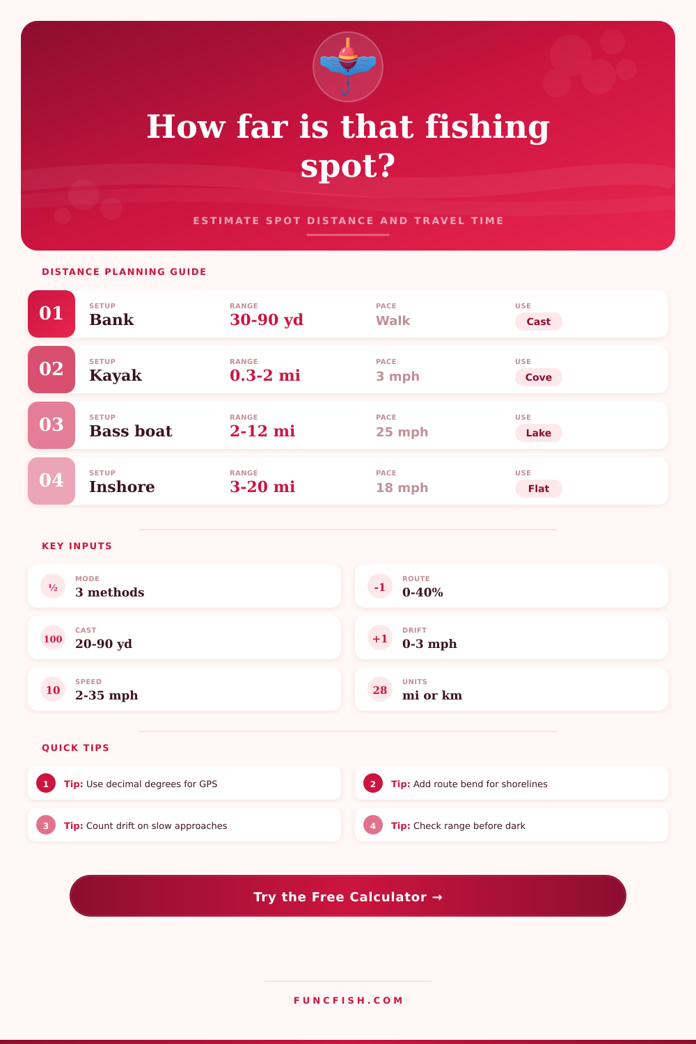
📏Distance and time planning table
| Fishing access | Practical distance band | Good calculator mode | Route adjustment | Useful output |
|---|---|---|---|---|
| Bank point, dock, or pier | 20-100 yd / 18-91 m | Range and bearing | Direct line | Cast count and stop-before target |
| Pond or small lake crossing | 80-600 yd / 73-549 m | GPS coordinates | Light shoreline bend | Walk, paddle, or electric motor time |
| Kayak cove, reef, or grass edge | 0.3-3 mi / 0.5-4.8 km | GPS coordinates | Moderate route bend | Paddle time and drift offset |
| Lake ledge, hump, or brush pile | 1-15 mi / 1.6-24 km | GPS coordinates | Islands or no-wake turns | Run time and route-adjusted mileage |
| Surf bar or outer trough | 50-180 yd / 46-165 m | Range and bearing | Direct line | Wade limit compared with casting reach |
| Unmarked offshore or lake structure | 150-900 yd / 137-823 m | Two-landmark triangulation | Light to moderate bend | Distance from landmarks and repeatable line-up |
🎯Species and approach reference
| Target pattern | Typical spot distance | Common approach | Cast or stop buffer | Distance note |
|---|---|---|---|---|
| Panfish around dock shade | 15-45 yd / 14-41 m | Bank, dock, kayak | 10-20 yd / 9-18 m | Short casts make small errors obvious |
| Trout seam or pool head | 20-70 yd / 18-64 m | Wading or bank | 10-25 yd / 9-23 m | Angle matters more than raw distance |
| Bass point or brush pile | 0.2-4 mi / 0.3-6.4 km | Kayak or boat | 25-60 yd / 23-55 m | Use route adjustment around points |
| Walleye drift edge | 0.5-8 mi / 0.8-12.9 km | Boat drift pass | 40-100 yd / 37-91 m | Drift can move you while you set up |
| Catfish channel bend | 80-900 yd / 73-823 m | Bank or anchored boat | 30-80 yd / 27-73 m | Current swings routes off straight line |
| Inshore flat or pothole | 1-12 mi / 1.6-19.3 km | Skiff, kayak, wade | 60-150 yd / 55-137 m | Give shallow fish a longer stop buffer |
🧭Method comparison table
| Method | Required inputs | Best use | Common error source | Output produced |
|---|---|---|---|---|
| GPS coordinates | Start and spot latitude/longitude | Known waypoint, launch, dock, or saved mark | Rounded coordinates or wrong sign on longitude | Great-circle distance and initial bearing |
| Range and bearing | Known distance plus compass direction | Visible targets, surf bars, docks, buoys, short marks | Range guess and magnetic/true bearing mix-up | Spot distance, reach, and estimated uncertainty |
| Two-landmark triangulation | Baseline and two sight angles | Repeatable line-up without saved GPS | Angles that are too shallow or do not sum correctly | Distance from landmark A, B, and midpoint |
| Route adjustment | Straight distance and bend factor | Shoreline routes, no-wake areas, shoals, islands | Underestimating detours in narrow or shallow water | More realistic travel distance and time |
Distance tip: Straight-line distance is the clean comparison number. Route-adjusted distance is the planning number when you must follow a channel, shoreline, no-wake zone, grass edge, or safe-water path.
Approach tip: For spooky shallow-water fish, make the stop-before-spot buffer longer than your best cast. For structure fishing, a shorter buffer can keep electronics, casts, and boat control aligned.
Planning a fishing trip require determining the distance to the fishing spot and the travel time to get there. The distance between the fishing spot and the fishing boat may not be a straight lines; other factors may limit the boat’s path to the fishing spot. Such factors may include shoreline bends or bars, no-wake zones, or other environmental considerations that can increases the travel time for the boat.
By increasing the travel time, the boat may miss the best time of year to catch the fish. The distance calculator produce mathematical results based on the selected calculation methods. You can use GPS coordinates if there are fishing spot marks save to the device or if there is a launch point visible from the boat.
How to Plan Distance and Time for a Fishing Trip
Range and bearing may be used if the fishing spot is visible from the fishing boat. Two-landmark triangulation may be used if only two fishable shoreline landmarks is needed and there are no electronic devices on the fishing boat. The distance calculator displays four specific outputs: the straight-line distance, the route-adjusted distance, the travel time, and the casting plan.
The straight-line distance calculate the shortest distance from the boat to the fishing spot. The route-adjusted distance takes into account any detours the fishing boat must take to stay on the safe route. The travel time calculates the time it would take the fishing boat to reach the fishing spot at the chosen travel speed.
The casting plan calculates the distance the fishing boat can travel from the stop-before buffer point. The distance outputs is crucial to understanding the approach the fishing boat must use to reach the fishing spot. For example, a bass boat and kayak may cover the same distance at differently rates.
If the distance to the fishing spot is six miles, the time needed to reach the spot may differ between the two boats. Drift may move the fishing boat away from the fishing spot before the fish are caught. The stop-before buffer may be used to give the fishing boat extra time and room to approach the fish.
If the fishing spot contain spooky fish that live in shallow waters, a larger stop-before buffer may be used. However, structure fishing spots may have a smaller stop-before buffer to keep the boat and fishing line in the best position to catch fish. Route adjustment can be a setting often forgot when planning a fishing trip.
While the shortest distance between two points is a straight line, not all routes are safe for fishing boats. There may be underwater hazards or rocks to consider while choosing a route. Such routes may increase the distance traveled by the fishing boat by twenty or thirty percent to avoid these hazards.
The distance calculator can be used to set different routes for the fishing boat to consider the differences in travel times in minutes. The travel times in minutes are the best estimate to alter the fishing boat’s fishing plan. Depending on the type of fish and the type of water where they live, the distance used to calculate the travel times to the fishing spot may change.
For example, panfish live within fifty yards of dock shade. Thus, any travel error over these distances may impact the ability of the fisherman to find these fish. Walleye may live on drift lines several miles away from where the fishing boat launches.
In these cases, the wind could impact the fishing boat’s position while it is fishing for walleye. Inshore flats may require the fishing boat to use longer stop buffers so that the fish cannot hear or see the boat moving. Reference tables on the page can assist the angler in determining the best distance calculations for the specific type of fish to catch.
Many people makes mistakes with the distance calculations when they use various units of measurement for distance. People may also make mistakes when they do not account for the difference between straight-line and route-adjusted distances. For example, a person may correctly enter the start and end coordinates in the distance calculator but forget to adjust the route factor for the travel distance.
Such a mistake will result in the persons travel distance being longer then they estimated the fishing trip will take. Other people may use their rangefinder to determine the distance to the fishing spot but ignore the effect of the wind on those measurements. The distance calculator will show the distance readings from the rangefinder so that people can decide if the fishing spot is worth the risk of travel errors.
Weather and light conditions may impact the distance calculations for travel time. A headwind may impact the travel speed of the fishing boat. In these cases, the boat will drift further from the fishing spot.
Low light may make it hard for people to triangulate the distance to the fishing spot. Because of this, low light makes triangulation less accurately to the actual distance to the spot. In these cases, a conservative speed and a larger stop-before buffer should of been programmed into the travel plan to account for these variables.
While the distance calculator will provide a good estimation of travel distance and time, the angler must use their experience with the area around the fishing spot to make final travel adjustments. The distance calculator can help a fisherman make better decisions with a variety of variables. For example, the fisherman could use the distance measurements to determine if a different boat ramp will save them travel time.
They could also use the distance to determine if moving their boat fifty yards will improve their ability to cast lines to the catchable fishing spot. These types of decisions can be made easier with the distance calculator set up to do the arithmetic for them. By using the distance calculator to determine the travel distance and time for the fishing boat to the fishing spot, the angler can focus on the fish and the fishing methods they will use to catch these fish.