Bearing Between Two Points Calculator
Calculate initial true bearing, final bearing, magnetic course, reciprocal return bearing, compass point, distance, ETA, and current-corrected heading between two fishing coordinates.
📌Navigation presets
⚙Bearing settings
Course and bearing results
Calculation breakdown
🧭Bearing reference cards
True Course
Magnetic
Final Bearing
Reciprocal
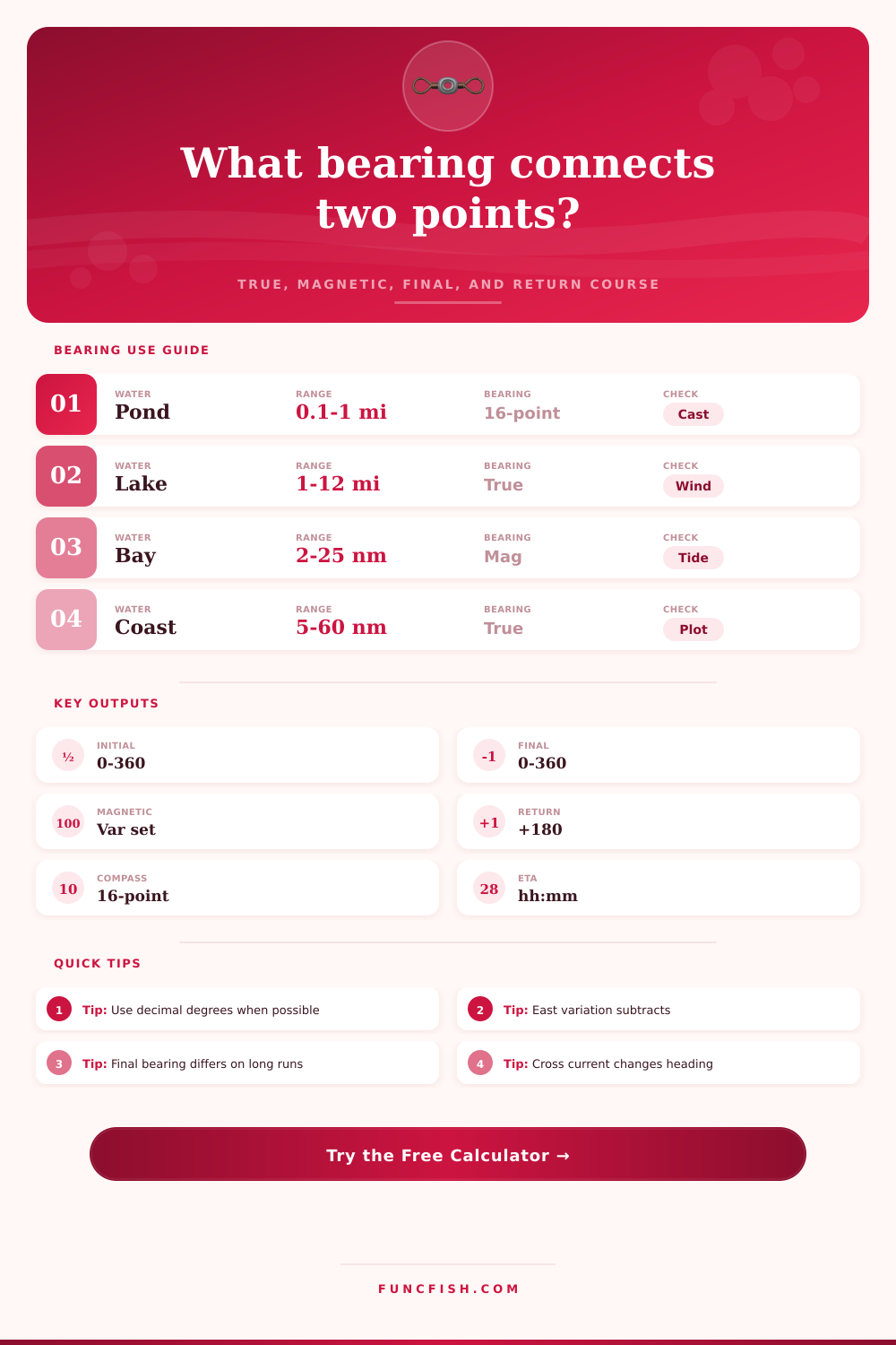
📊Navigation bearing guide
| Bearing type | What it means | Fishing use | Important check |
|---|---|---|---|
| Initial true bearing | Great-circle course leaving the start point | Set first run from ramp to waypoint | Use with GPS map north |
| Final true bearing | Course direction as you arrive at the target | Line up a trolling pass or reef approach | May differ on longer routes |
| Magnetic bearing | True bearing corrected for local variation | Steer by hand compass or boat compass | East variation subtracts, west adds |
| Reciprocal bearing | The opposite direction, normalized to 0-360 | Return from spot to launch after dark | Recalculate if you move far off course |
| Current-corrected heading | Steering course that offsets side set | Hold a cleaner path across tide or wind | Needs current speed and set direction |
📍Compass point table
| Compass point | Degree range | Plain direction | Common fishing use |
|---|---|---|---|
| N | 348.75-11.25 | North | Shoreline alignment |
| NE | 33.75-56.25 | Northeast | Point to cove run |
| E | 78.75-101.25 | East | Sunrise bank check |
| SE | 123.75-146.25 | Southeast | Bay marker approach |
| S | 168.75-191.25 | South | Return lane reference |
| SW | 213.75-236.25 | Southwest | Wind-protected bank |
| W | 258.75-281.25 | West | Evening ramp line |
| NW | 303.75-326.25 | Northwest | Island gap crossing |
🚤Fishing route profiles
| Profile | Typical speed | Bearing precision | Route allowance |
|---|---|---|---|
| Bank or shoreline walk | 2-4 mph | Compass point | 10-28% bends |
| Fishing kayak | 2-5 kt | 5-degree checks | 5-18% wind set |
| Jon boat | 8-18 kt | 3-digit bearing | 5-18% channels |
| Bass boat | 20-45 kt | 3-digit bearing | 5-10% points |
| Bay boat | 16-34 kt | True plus magnetic | 10-28% shoals |
| Offshore run | 18-38 kt | True plus final | 5-18% sea room |
ℹCourse notes
Coordinate note: Enter latitude and longitude as decimal degrees. West longitudes and south latitudes are negative, which matches most GPS waypoint exports.
Compass note: This calculator treats east magnetic declination as positive. A +6 degree east declination changes a 120 degree true course to a 114 degree magnetic course.
Current note: The steering correction is a planning estimate. Tight channels, shallow bars, changing wind, and slow trolling passes deserve frequent visual and GPS checks.
A bearing between two points represent the direction that a person uses to travel from one location to another location. If a person choose the correct bearing between two points, that person will save time on the water and burn less fuel during their journeys. A bearing between two points calculator can take a person’s latitude and longitude and provide a series of number that represent the bearing between the two points of interest.
These numbers include the initial true course, magnetic heading, final bearing on arrival at the second point, and the reciprocal bearing. In addition to these bearings, a bearing between two points calculator also calculates the distance between the two points of interest, the estimated time of arrival at that destination, and provide corrections for water current or wind to adjust for a person’s steering course. A bearing between two points is not a single number.
How to use a bearing between two points calculator
Instead, there are four different types of bearings that is useful for a person traveling between two points on the planet. The initial true bearing is the course that a person takes from the point of origin. The final bearing is the direction of the destination, and it may not be the same than the initial true bearing due to the curvature of the earth.
The magnetic bearing is the angle that a person’s compass read after applying magnetic declination to the true bearing. Finally, the reciprocal bearing is the angle that a person use to return to the origin point from the destination. This is calculated by simply adding 180 degree to the initial true bearing to calculate the course to take to return to the point of origin.
By understanding all four type of bearings, a person cannot make the mistake of using the outbound bearing to return to the origin point. To use the bearing between two points calculator, a person must enter several different data points. The first of these data points is the water type and boat profile.
These will determine the default speed of the boat and the route allowance. A route allowance account for a person’s distance traveled and allows an extra percentage of distance for the boat to travel. Depending on the type of water that is to be traveled in and the type of boat that will be used, this route allowance can change.
For example, a person who is traveling in open water in a bass boat may have a different route allowance than a person driving an jon boat in a river. In addition to these parameters, a person must enter the declination of the area in which they will be traveling. Declination is used to calculate the magnetic bearing of the journey.
If declination isnt entered into the bearing between two points calculator, the magnetic bearing will be incorrect by ten degrees or more. Other parameters that can be entered are the speed of the current in the area and the direction of that current. A person can enter this information voluntary.
If these parameters are entered, the bearing between two points calculator will provide a corrected steering course for that boat. A corrected steering heading takes into account the movement of water. For instance, if the bearing between two points calculator determine that a current will push a boat at a specific angle, the bearing between two points calculator will provide a corrected steering heading for that boat to steer into the current to reach the calculated destination.
If a kayak or small boat is to be used, this is also important to account for the movement of the boat due to wind and water currents. The bearing between two points calculator can provide a starting number for those trips that is more accurate than a simple calculation of bearing between two points. This initial calculation takes into account the variables of water and wind movement.
On long trips, the bearing between two points calculator may indicate that the final bearing of the trip may not be the same than the initial bearing of the journey. This occurs because the planet is a curved object. These bearings are provided to a person side-by-side for that person to understand the difference between the initial and final bearings.
Additionally, the bearing between two points calculator may also provide reference cards to a person that indicate whether a given bearing belong on the GPS device that a person is using or whether that bearing belongs on the boat’s compass. In addition to calculating the bearings between two points, the bearing between two points calculator can also calculate the distance between these two points and the time it will take for the person to reach the destination. The route allowance can be applied to the distance between the two points of interest to provide a distance in nautical miles or statute mile.
If a person enters a speed into the bearing between two points calculator, the distance between the two points will be converted into an estimated time of arrival at the second point. This estimated time of arrival will factor in the effect of the current on the travel of the boat. This estimated time of arrival will indicate if a person will arrive at the final destination prior to the tide turn in that area.
An estimated time of arrival can also provide information regarding an estimated time of arrival in still water to demonstrate the effect of water currents on the travel time between the two points of interest. A compass point table is also provided for a person to quickly determine the direction of a bearing. This table indicate which cardinal direction (e.g. Northeast) corresponds to the degree measurements of the bearing between two points.
This is helpful for a person to be able to understand the direction they are traveling without having to read the small numbers on a screen in the bright sunlight. Using this table will ensure that a person does not misread the bearing between two points on the screen. Using the bearing between two points calculator prior to a trip will also help a person to ensure the accuracy of the coordinates entered into the calculator.
If a person enters a coordinate incorrectly into the bearing between two points calculator, the calculator will display a distance that is incorrect or a bearing that is incorrect. The bearing between two points calculator will also highlight if two coordinates are identical so that a person can correct any error made on the dock. The bearing between two points calculator will calculate a midpoint between the two points of interest.
This midpoint can serve as a visual point of interest for a person during travel between the two points. The bearing between two points calculator can also act as a baseline that a person use during the trip. For instance, if a person enters the bearing between two points calculator prior to a trip and calculates the bearings between the two points of interest, the person can use those calculated bearings while on the trip to determine if the actual condition (i.e. The wind, the currents) have changed from those the bearing between two points calculator calculated in advance.
Additionally, if a person knows the magnetic bearing that they wish to take between two points of interest, as well as the correction for the current, a person can use a compass to ensure that they are on the same track that was calculated with the bearing between two points calculator. The reciprocal bearing is also pre-calculated so that, should a person decide to turn around and return to the point of origin, they can easily determine the course that they should use to return to their point of origin. Thus, the bearing between two points calculator provides clarity to a person regarding any decision that they must make, and the bearing between two points calculator provides assistance to a person to ensure they can follow their plan for their trip.