Grid Search Pattern Calculator
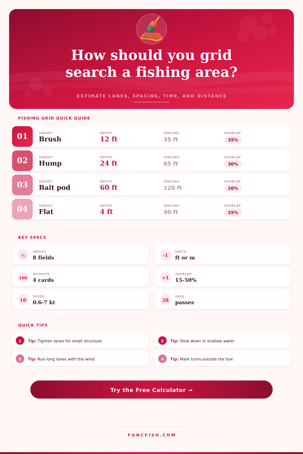
Plan repeatable fishing search lanes for bait schools, brush piles, humps, weed edges, flats, and lost tackle by matching sonar coverage, depth, overlap, boat speed, and search-box size.
📌Fishing grid presets
⚙Search pattern inputs
Grid search estimate
Formula breakdown
📡Sonar and pattern data grid
Best for finding structure, bait clouds, weed gaps, and bottom changes.
Down-looking coverage grows with depth but shrinks over shallow flats.
Use lower overlap for scouting and higher overlap for tiny targets.
Slow controlled lanes give cleaner returns and steadier waypoint marks.
🎣Gear and species comparison grid
Tight side-scan lanes over marked cover; hold speed near 2.0 to 3.0 kt.
Detail passes help separate small branches, fish stacks, and shadows.
Moderate overlap is enough when mapping larger breaks and rock transitions.
Wide side imaging and faster lanes cover water while marks remain visible.
Broad shallow sweeps work when the target is a school, pothole, or ray trail.
Follow the channel shape and use added overlap around seams and log jams.
Short slow lanes keep the edge centered and make turn drift manageable.
Recovery grids need narrow lanes, high overlap, and repeat passes from another angle.
📊Reference tables
| Electronics mode | Practical coverage | Best use | Speed note |
|---|---|---|---|
| Side imaging detail pass | 70 ft / 21 m total | Brush, rock, small wrecks | 1.5 to 3 kt |
| Side imaging mid range | 120 ft / 37 m total | General structure search | 2 to 4 kt |
| Side imaging wide range | 200 ft / 61 m total | Bait schools and flats | 3 to 6 kt |
| Down imaging cone | Depth based | Confirming marks under boat | 1 to 3 kt |
| Forward live sonar | 60 ft / 18 m fan | Pointing at fish or cover | 0.5 to 2 kt |
| Search objective | Target size basis | Overlap range | Pattern note |
|---|---|---|---|
| Single cover | 10 ft / 3 m | 35 to 50% | Use a second cross-grid if the first pass misses. |
| Edge trace | 20 ft / 6 m | 25 to 35% | Run lanes parallel to the expected edge. |
| Hump zone | 35 ft / 11 m | 20 to 35% | Include the crown and both breaklines. |
| Bait school | 60 ft / 18 m | 15 to 25% | Wider lanes are acceptable for moving targets. |
| Lost gear | 5 ft / 1.5 m | 45 to 50% | Keep lanes narrow and mark every possible return. |
| Platform | Steady search speed | Turn allowance | Best match |
|---|---|---|---|
| Pedal kayak | 1.5 to 2.8 kt | 25 ft / 8 m | Weed edges, shallow flats, small ponds |
| Bass boat trolling motor | 1.8 to 3.2 kt | 45 ft / 14 m | Brush piles, docks, humps |
| Center console idle | 3 to 5 kt | 90 ft / 27 m | Bays, reefs, channel edges |
| Offshore boat | 4 to 7 kt | 150 ft / 46 m | Bait pods, rips, wreck zones |
| Ice walking grid | 0.6 to 1.2 kt | 10 ft / 3 m | Basin hole spacing and sonar checks |
| Calculated item | Formula | Used for | Interpretation |
|---|---|---|---|
| Effective sweep | Raw coverage × clarity × speed factor | Usable detection width | Conservative value before overlap. |
| Lane spacing | Effective sweep × (1 - overlap) | Distance between track lines | Smaller spacing gives fewer missed strips. |
| Pass count | Ceiling(width / spacing) + 1 | Number of parallel lanes | The extra pass closes the far edge. |
| Route distance | Passes × length + turns | Total search travel | Includes out-of-box turn allowance. |
| Search time | Distance / speed + turn penalty | Time on pattern | Add setup time for waypoint naming. |
💡Calculation tips
Grid searching is one way to cover water in a more methodical fashion while keeping yourself out of empty water. Instead of just making long runs and burning gas in all directions, grid searching allow you to draw a box and determine how many lanes you want. Then, you can make your parallel runs until you’ve covered your desired area.
By plugging your size into the previous calculator, it will do the conversion and coefficient math for you so you don’t have to guess. The key ingredient here is overlap. I know it doesn’t make sense to cover the same area twice, but running over that last piece of water wastes so much more time than making one additional pass. If you’re targeting something such as a lone brush pile or missing anchor, higher overlap means the sonar cone will catch each and every inch of water. On the opposite end, if you’re scanning for a huge bait school, you can space them out a bit more because target is obvious and big.
How Grid Searching Works
When setting lane spacing, most folks do so by what they think they should be able to visually see on the screen. Wrong. The screen shows potential range, not guaranteed detection in messy bottoms or muddy water. In the physics of search, speed makes all the difference. Side imaging is not a photograph; rather, it’s a bunch of snapshots pasted together as you move along. Speed up and the picture elongates, the smaller features blur out into noise. Go slower and you’ll get cleaner returns and more reliable waypoint marks to return to if needed. This means you have to accept that maybe you cruised right past the hump because you were going five knots. That’s why the tool adjust its effective sweep width according to the speed you choose.
Your sonar mode determines your geometry. With fixed fan-like side imaging, the spacing will remain fairly consistent based off how much water you have above it. This holds true as long as it can see down that deep. A cone like down imaging get bigger the deeper it gets, which means you need to space your lanes closer together in shallower water, or further apart if fishing a channel that’s deeper. Mixing modes without changing your pattern makes for a lot of wasted effort. You can run wide lanes with down imaging and miss spots all over because you didn’t adjust your pattern. Then, you can run really tight lanes with side imaging and not know why.
Turns take time, and that’s where platform really makes a difference. A kayak is nimble but hampered by the range of its pedals. At idle, a center console will drift into corners and waste both fuel and time. A bass boat under power has pinpoint steering, but it only make slow turns. Each platform’s turn allowance is factored into the calculator as those U-turns account for considerable distance on your route. Plan on ignoring the turning radius and your estimate of search time will be optimistic. It’s about stop-and-go and back-and-forth reality.
What has absolutely zero to do with electronics is the fact that depth also dictates visibility. Under the boat, especially in shallow water, you have a blind zone created by surface reflection and the boat’s shadow. No matter how much you pay for a transducer, you can’t see what’s right there. If you are working in flats under ten feet, you need to run closer lanes or rely strictly on side imaging. In deep water you introduce angle issues that reduce resolution as the sonar beam contacts structure at slanted angles.
Finding fish is not like a lost gear search. That’s a needle in a haystack. It becomes more about recovering something versus mapping. It would of been better to have high overlap and narrow lanes. There could also be a second cross-grid pattern to verify the marks. Fish change. Your favorite lure doesn’t. That changes how you look at the data. One requires probability, while the other require certainty.
The one variable that blows all the moddern models up is water clarity. Side imaging gets cut in half by stained water. Down-imaging returns are completely clouded out by cold mud. You have to manually tighten your grid based on these variables, not just the preset settings. The page has a good chart showing how it should work in normal conditions, but the ultimate judge comes down to your eyeballs. Does it look muddy and gray on the screen? Slow down and get closer.
All of this boils down to a matter of confidence. It is the difference between hoping you saw something and knowing you checked everywhere. You sacrifice efficiency for certainty. Checking an area completely takes time, whereas skimming will take less time but will also leave some areas unchecked. That’s what the calculator provides, allowing you to make the sacrifice efficiently with the numbers in your hand. You’re still going to have to put in the time. But you’ll know for certain the places you covered and, even better, the places you didn’t cover.