Stream Gradient To Holding Water Calculator
Convert reach drop and distance into stream gradient, drop rate, pool spacing, refuge quality, and fish holding water score using channel width, depth, cover, roughness, flow stage, and target species.
📌Stream reach presets
⚙Gradient and holding water inputs
Stream gradient and holding water results
Calculation breakdown
📊Quick habitat indicators
Shows how quickly energy changes relative to stream size.
Difference between main current and holding lane speed.
Estimated count within the measured reach.
Gradient-based water type for fishing interpretation.
🗂Comparison grid
Low-gradient glide
Soft slope can hold fish where bends, undercuts, deeper troughs, or wood create cover and current definition.
Riffle-run sequence
Moderate gradient often creates oxygen, drift, seams, and repeatable buckets without making every lie too fast.
Pocket water
Steeper water can fish well when boulders, steps, and plunge depth create short but efficient holding spots.
Pushy chute
Very steep or high-stage water needs obvious refuge. Without depth and cover, fish usually slide to edges.
📘Reference tables
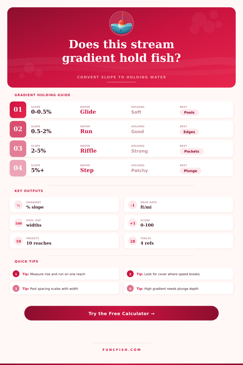
| Gradient band | Drop rate | Common water | Holding pattern | Fishing interpretation |
|---|---|---|---|---|
| 0 to 0.5% | 0 to 26 ft/mi / 0 to 5 m/km | Pool, glide, backwater edge | Holding depends on depth, cover, bends, and temperature relief. | Look for wood, undercuts, shade lines, and subtle current seams. |
| 0.5 to 2% | 26 to 106 ft/mi / 5 to 20 m/km | Run, riffle, pool-riffle | Often the most balanced holding water when depth and cover are present. | Fish the heads and tails of pools, inside soft seams, and broken riffles. |
| 2 to 5% | 106 to 264 ft/mi / 20 to 50 m/km | Fast riffle, pocket water, step transition | Holding becomes more concentrated behind boulders, ledges, and plunge lips. | Target short casts to defined pockets and current cushions. |
| 5 to 10% | 264 to 528 ft/mi / 50 to 100 m/km | Step-pool or chute | Fish need plunge depth, large roughness, or edge slack to hold efficiently. | Skip featureless chutes and spend time on plunge pools. |
| 10%+ | 528+ ft/mi / 100+ m/km | Cascade | Usable water is patchy and often limited by passage, depth, and flow stage. | Fish only obvious buckets, shelves, and tailouts in stable flow. |
| Target | Preferred gradient | Useful depth | Refuge speed | Primary holding cue |
|---|---|---|---|---|
| Trout | 0.7 to 4% | 1 to 4 ft / 0.3 to 1.2 m | 0.5 to 2 ft/s / 0.15 to 0.6 m/s | Drift lane beside soft holding current. |
| Smallmouth bass | 0.3 to 2.5% | 2 to 6 ft / 0.6 to 1.8 m | 0.3 to 1.5 ft/s / 0.09 to 0.46 m/s | Ledge, shoal edge, boulder seam, or tailout. |
| Steelhead or salmon | 0.5 to 3.5% | 2.5 to 7 ft / 0.8 to 2.1 m | 1 to 3 ft/s / 0.3 to 0.9 m/s | Travel lane with cushion water and resting slots. |
| Catfish | 0.1 to 1.5% | 4 to 12 ft / 1.2 to 3.7 m | 0.1 to 1.2 ft/s / 0.03 to 0.37 m/s | Deep bend, outside scour, log edge, or tailrace seam. |
| Panfish | 0 to 1% | 1.5 to 5 ft / 0.5 to 1.5 m | 0 to 0.8 ft/s / 0 to 0.24 m/s | Slack margin close to food, shade, or vegetation. |
| Roughness or cover | Holding effect | Gradient where useful | Pool spacing effect | Calculator treatment |
|---|---|---|---|---|
| Smooth sand glide | Few speed breaks unless bends or wood are present. | Low gradient | Longer spacing, fewer pockets. | Lowers structure score and raises spacing widths. |
| Gravel riffle | Creates shallow oxygen and drift but modest refuge. | Low to moderate | Normal pool-riffle spacing. | Neutral roughness baseline. |
| Cobble and ledge | Builds seams, buckets, and holding lanes. | Moderate to steep | Shorter pocket spacing. | Adds roughness and refuge support. |
| Boulder pocket water | Strong current cushions and plunge pockets. | Moderate to high | Many short features. | Raises high-gradient holding potential. |
| Wood and undercut banks | Excellent low-gradient cover and shade. | Low to moderate | Feature spacing follows cover clusters. | Adds cover and thermal score. |
| Field measurement | Simple method | Best reach length | Common error | How to improve it |
|---|---|---|---|---|
| Reach length | Map trace, GPS track, or measured tape along channel. | 10 to 30 channel widths | Using straight valley distance instead of stream distance. | Follow the thalweg or centerline through bends. |
| Elevation drop | Survey rod, laser level, topo map, or reliable GPS average. | Same endpoints as reach length | Measuring only one chute or one pool tail. | Average across a representative sequence. |
| Velocity | Float timing adjusted by about 0.8 for mean speed. | Several lanes | Using only the fastest surface thread. | Measure main current and the actual holding lane. |
| Width and depth | Average fishable width plus best holding depth. | 3 to 5 cross sections | Using bankfull width at low flow. | Use current wetted width for fishing decisions. |
✅Calculation tips
A fish doesn’t care if there is a flow of water coming down; all it cares about is how the water breaks. When there’s that straight shot of current, it’s just energy until something interrupts it and creates a seam. Now there’s some food drifting by and you can conserve fuel.
So speed depend on stream gradient, which sets the base line. But then structure define whether that speed holds fish or pushes them out.
How Stream Slope Helps You Find Fish
Once you measure your reach and put those numbers into the calculator above, it spits back out a number that saves you from having to guess at how much slope equates to actualy holding water quality. It take raw elevation drop and turns it into a habitat score based off depth, cover and velocity relief so you have a practical idea of what to expect without ever wetting a line.
Rise over Run: Gradient is just another word for rise over run. Often given in terms of feet per mile, or more commonly, its a percentage. A shallow gradient make glides with subtle slopes. The current provide little resistance here, so fish hide in bends, undercut banks and wood. Steeper gradients forms runs and riffles that cause drifting while aerating water but come at a higher price (increased metabolic cost).
Where does the energy peak and suddenly drop off? There’s your fish. They’re waiting there in that drop zone. What you want to see is a sharp contrast from the fast main current to slower holding lanes. Smallmouth and trout feels like they’re on a treadmill if not. Even if depth is ideal, no one wants to work for nothing.
The trick with measuring gradient is to do it from centerline of stream (i.e., don’t cut directly across the valley). Gradient measured this way will be more accurate since it avoids error most folks make by measuring map distance but not accounting for meanders. To measure accuratley, follow the thalweg; the lowest portion of the channel, and take a representative reach of about 10-30 channel widths in length. Averaging over that section remove any local anomalies such as an isolated pool or large boulder. It reveals rhythm of stream itself.
Once you have an idea of how much the water drops over a representative reach of stream, use graph on page to match your average gradient to expected habitat patterns. Calibrate your expectations of what sort of water structure ought to exist at that gradient. The tool use the gradient and then calculates cover density and roughness.
Now people get tripped up thinking that only rock bottoms are rough. In reality, it is any bottom that block the current. This cause things like eddies and breaks in the current. Without a deep pool or heavy wood, sand can be very smooth and offer little help. Boulder and cobble beds will generate their own pocket water when sloped moderatly so many small refuges are created. Adding another layer, wood provides shade and complex flow patterns close to bank.
The tool weigh those elements along with your desired fish species. Catfish wants slow, deep areas in flat river systems. Trout like cooler water and consistent drift lanes. Smallmouth bass love broken current and ledge edge where they can hang out and ambush prey without having to work too hard.
But how deep? Depth alone isn’t always relevant. You can have two feet of water with a fast chute through it, but there is zero cover between you and the bank. That is worthless. Or you could have three feet of still water, warm enough for panfish on a summer day but too slow than trout. Holding water incorporate both of those factors into one number. A good score typically means the gradient give them just enough lift to keep oxygen and food moving. It does this without requiring so much effort that they are exhausted, allowing structure to provide relief so they could of saved their strength.
The model is always complicated in real world conditions. Rain can make water muddy and drive fish up on shallow water with better visibility to ambush insects even at higher flows. Temperature and seasonal changes can alter the environment and move where fish hold, shifting from deep pools in the summer to lower, slower runs with surface current in the spring. And then there’s angling pressure, wary fish tend to get pushed out deeper in the slots and to edges when pressured. So while calculator provides a good starting point for scouting, you need your eyes to fill in the details.
Seek out where the main flow breaks across some type of structure, where riffles tailout to softer pools, and where clear water transitions to darker shadowed cover. These are the areas that gradient make opportunity. Knowing how slope affects water behavior transform random casting into targeted fishing and allows you to read the stream instead of simply watching it go by.